Boundary analysis
Boundary analysis, which is often referred to as districting, helps define regions according to certain criteria. This procedure has been used in Volusia County for County Council, School Board and election precinct redistricting. Since districting is normally an iterative process involving the development of numerous scenarios based on various combinations of desired criteria, the computing power of the GIS proves to be a real timesaver. Rather than struggling with paper maps and adding machines, staff is able to interactively define proposed boundaries and have related population or voter totals automatically computed in a matter of minutes.
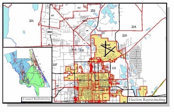
In the case of County Council redistricting, 27 redistricting maps and numerous work maps were prepared by GIS staff for consideration. Interim work products included maps with pie charts showing the racial mix within each Census block, major population centers within the County, and redistricting scenarios suggested by members of the public. The plan adopted by the County Council and School Board contained an overall deviation from optimal population per district of less than one percent.
The redistricting of state and county political districts combined with increasing voter turnout made it imperative that election precinct boundaries be revised. The process involved the assignment of a certain number of voters to each precinct and the identification of polling places with sufficient capacities and appropriate locations to accommodate the voters. Prior to using GIS, developing potential reprecincting scenarios was a formidable task for Elections personnel. First, it was necessary to examine paper maps to identify streets whose voters could possibly be assigned to a neighboring precinct. Then, staff would wade through voluminous computer printouts to identify and tally the total number of voters living on those streets. With GIS, Elections staff can display a map on the screen showing precincts, streets, and voters living on each street. Then a determination can easily be made of the number of voters residing on a particular street. Those voters can then be easily reassigned to new precincts. Based on the constraints of various polling places, voters can be aggregated quickly and a wide variety of scenarios run prior to actually dividing a precinct.