Volusia County Council Advances Five Flood Mitigation Initiatives
Posted On: October 22, 2025
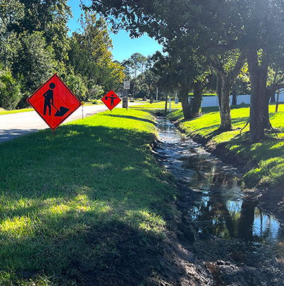
The Volusia County Council approved five flood-mitigation initiatives during its Oct. 21 meeting, furthering efforts to reduce neighborhood flooding and strengthen community resilience across the county. Funded through the federally supported Transform386 program and developed in partnership with several municipalities, the projects include engineering design work and detailed flood studies aimed at identifying long-term solutions to increase stormwater management capacity. These projects reflect coordinated efforts between Volusia County and its municipalities to strengthen drainage systems and protect neighborhoods across the county.
City of South Daytona – Stevens Canal: This project includes engineering design for flood-mitigation improvements along the Stevens Canal corridor, which runs through the center of South Daytona from just north of Beville Road south to Reed Canal. The design will include sheet-pile wall installation, yard drains with flap valves, upgraded backflow preventers, and new wall structures at key road crossings such as Ridge Boulevard and Big Tree Road.
City of DeLand – DeLand Ridge Watershed: This effort targets drainage basins throughout the unincorporated areas of DeLand and Orange City. The study will model how runoff moves across this elevated sandy ridge and into low-lying basins and will develop pre-engineered conceptual alternatives to reduce roadway and yard flooding.
City of Deltona – Providence Basin: Serving neighborhoods along and south of Providence Boulevard near Braddock Road, this 1,200-acre watershed drains toward Lake Monroe. The analysis will evaluate drainage across residential streets and wetlands and propose alternatives to enhance flow and alleviate flooding in low-lying areas.
City of Deltona – McGarity Basin: Covering roughly 3,800 acres—including the Sidney, McGarity, Big, Diana, Tivoli, Lehigh, and the Lorraine Lake system—this basin runs north to south across central Deltona near Providence Boulevard and Normandy Boulevard. The study will create alternatives, such as stormwater pumping, grading improvements, or enhanced storage features, to reduce flooding and improve stormwater flow toward Lake Monroe.
City of Deltona – Gleason Basin: The Gleason Basin spans about 4,200 acres—roughly six-and-a-half square miles—generally bounded by I-4 to the west with a series of lakes and wetlands running north to south. It drains residential areas around Lake Gleason and surrounding neighborhoods south toward Lake Monroe. Engineers will identify alternatives to enhance stormwater conveyance, reduce localized flooding, and improve downstream water quality.