Countywide Aerials
About our aerial photography
If you use any of our mapping applications, you may have seen the high-quality aerial photography that we have for all of Volusia County. The Map Kiosk and the Property Appraiser’s Map both have been updated to include new images taken between January and March by EagleView, a company under contract to the County Property Appraiser’s Office. This imagery is a combination of 3” pixel imagery collected in urban areas and 9” pixel imagery collected in more rural areas. These full-color photos have a resolution fine enough that each pixel (the little squares that you see when you zoom in too much) is either 3 inches or 9 inches of the land's surface. To view this imagery go to either of the interactive maps mentioned above.
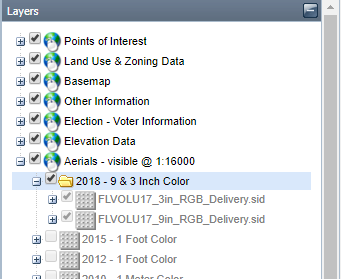
In the Kiosk, zoom into your area of interest and then, under Layers, Click the plus sign next to the Aerials listing. This exposes all the year sets of aerials available (note they go back to 1999). They will stay gray until you’ve zoomed close enough to the ground for them to display.
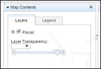
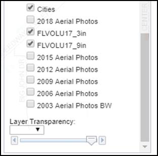
 In the Property Appraiser’s Interactive map, click the plus sign to the left of the Parcel check box to expose the layers of data available, then use the slider bar to see the check box for the Aerial Photos and check it on.
We also offer in both those mapping applications images taken in multiple years through a partnership between the Florida Departments of Revenue and Transportation. These full-color photos have a resolution fine enough that each pixel (the little squares that you see when you zoom in too much) is one square foot of the land's surface.
Aerial Photography can be downloaded by utilizing the FDOT website via this link: https://fdotewp1.dot.state.fl.us/AerialPhotoLookUpSystem/
Looking for Historical Aerial imagery? LABINS or the University of Florida have imagery libraries.
One of the reasons this imagery exists is to facilitate local land management, planning, and engineering projects. If you have an interest in this, we provide tools for using this imagery.